
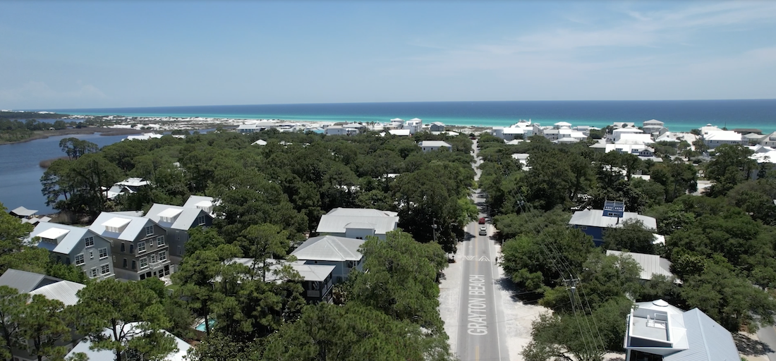
Less than 65 years ago, Scenic Highway 30A – a bustling two-lane road, often overcrowded with cars, golf carts, and streams of bicyclists and pedestrians shuttling between ever-more-popular beach communities – was simply two tire tracks cut through the grass.
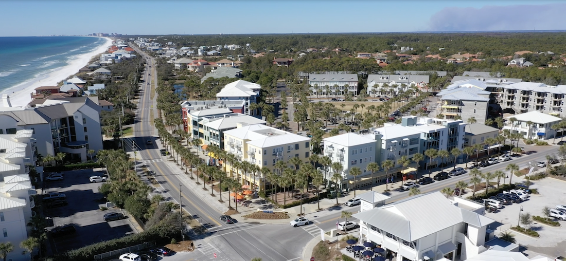
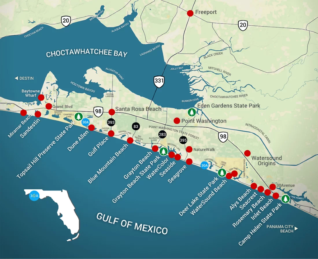
This sliver of a road, which travels along 20 miles of the Gulf of Mexico shoreline, has become the hallmark of one of the hottest beach destinations in the country.
But as recently as the late 1950s, it was simply a path of vegetation worn down by the few visitors and residents who ventured to this unbelievably remote and pristinely beautiful part of Florida. The story of the road is also the story of this place, which, only a handful of decades ago, was so beloved by few and today is becoming beloved by people all over the world.
")

In 1902, William Leslie Miller packed up his wagon and took his family and some livestock from their home near Vernon, Florida, to what is now known as Grayton Beach, but was then just an area along the gulf where no one else lived.
Miller homesteaded 320 acres, the heart of which was the Old Miller Place, a compound of two houses that held all the kids, grandkids, and always at least a visitor or two, said Malcolm Patterson, Miller’s grandson. (The homestead is still marked today by a sign just east of the entrance to Grayton Beach State Park.)
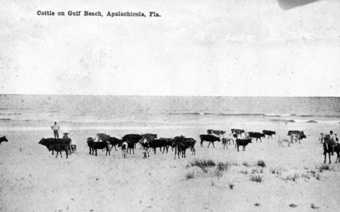
He raised hundreds of cattle that roamed freely, with no fences needed. At the time, this part of Florida was practically an island; it was so isolated. Without bridges, the land was cut off from other areas by water: Destin Pass to the west, Lake Powell to the east, Choctawhatchee Bay to the north, and the Gulf to the south.
In front of the Old Miller Place, a path was worn into the sandy grass, a rut road formed by two-wheel tracks. The seeds of 30A were planted.
")
")
By the early 1930s, a handful of families had built cottages in Grayton Beach and other spots along this stretch of coastline, including around Draper Lake and the area now known as Seagrove, but the place was still incredibly remote. Construction of U.S. Highway 98 and the bridge over the bay at U.S. Highway 331 started to change that, but barely.
“It was unbelievably isolated,” Patterson said. “Not only was it isolated by geography, but it was isolated because of space and population.”
Patterson’s mother had moved his family to Pensacola, where there were schools for the children to attend. But he remembers being put on a bus at eight or nine years old, headed for Grayton to help at the Miller homestead.
Destin was a tiny place then, yet the trip became even more remote as the bus traveled onward toward Grayton. Often Patterson would see no other cars on the road. “It was nothing but pine trees, palmetto, and rattlesnakes,” he recalled.
The bus stopped at the corner of U.S. 98 and the rough road into Grayton. Patterson would step out with a brown paper sack as a suitcase and walk down to his family’s home. He helped wrangle cattle, which, since they roamed free, often had to be rounded up for branding or other checks. Patterson joined a group of men, each assigned a different section of land for wrangling. Patterson always hoped to get sent to the beach where cows could be found wading in the calm gulf waters, and he could ride his horse through the sand and waves.
During this time, Van Ness Butler and a few other families established cottages in Grayton Beach. Butler opened the area’s first store, Butler General, which also served as a dance hall.
In 1937, according to state records, Florida officially established the rut road as a state road, though it wouldn’t gain the moniker “30A” for another 20 years.
")

Electricity came in the 1940s, along with a limit on free-grazing cattle, which put an end to Patterson’s grandfather’s business. A few more families set up camp in the area, but growth was still slow and meandering.
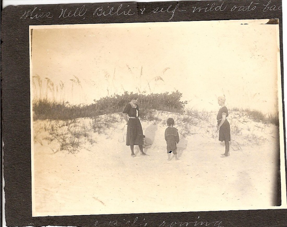
Becky Steele, whose family built a cottage in Grayton Beach in the mid-1950s and became some of the first full-time residents there, remembers hardly ever making the trip to Seagrove, just a few miles away. It was too difficult to get to. A bridge had yet to be built over Western Lake, so they would have to go north on a rough road to U.S. 98 and back down another bumpy road into Seagrove.
The people in each of the tiny beach communities mostly kept to themselves. New visitors were a big occasion.
“We were always in the Butler store,” recalled Steele. “We would hang our heads out the store window if we heard tires coming down the road. There was no one else in town.”
If they did head over to Seagrove, Steele said, they often drove in the sand along the beach, a more direct route. Her dad would take old cars and convert them into beach buggies, as they called them. One of her first memories was of an old wood-paneled Rambler station wagon with its doors removed. Her mom was so afraid to get stuck in the sand that she would hit the beach at full speed and not stop until they got to the water.
Around the same time, the state began planning to pave the rut road and build bridges across the lakes to connect the burgeoning beach communities. In 1958, according to state transportation records, Florida added the rut road to the state highway system and gave it the now-famous designation of 30A.
The original plans took 30A through downtown Grayton Beach, but the residents wanted to avoid dividing their community with a highway. They contested the plan, and the road was rerouted, swerving north around Grayton and then back down again.
Patterson remembers his whole family getting together at the Old Miller Place and visiting with a man from the state Department of Transportation to negotiate the land rights they would need to complete the road. Most of the Miller’s land, no longer used for cattle or homesteading, went to the state for the new 30A road.
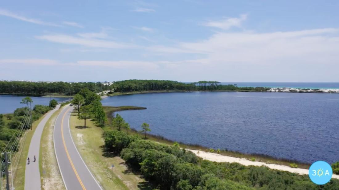
Surveying and construction of the paved 30A began in 1959 and continued on into 1961, according to state records. The two-lane road was 22 feet wide and cut through arguably some of the most beautiful scenery in the country. Bridges were constructed over the coastal dune lakes, connecting all the small beach communities to each other for the first time.
“As a teenager, I remember that being so exciting,” Steele said. “Now, you could go straight to Seagrove. We didn’t know the people very well because it had always been so hard to get there, and now there were all these new people to meet.”
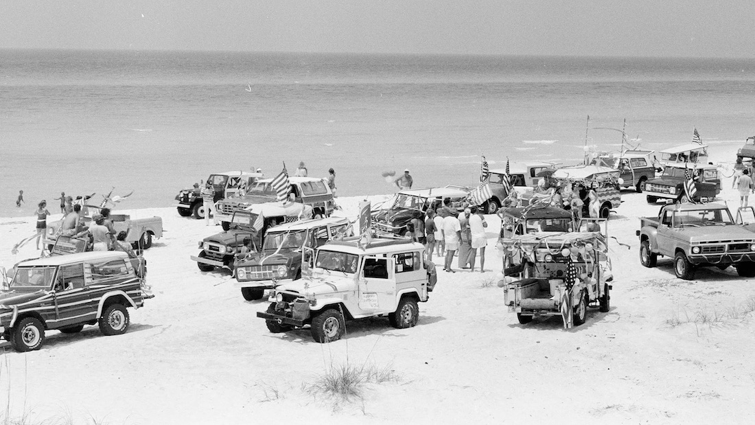
But, the paving didn’t immediately bring crowds flocking to the fledgling area.
Brenda Rees remembers as a kid in the early 1960s, she would walk barefoot down the middle of the road from their home on the shore of Eastern Lake to the Seagrove Village Market. They’d get ice cream; if the road was too hot after, they might take the beach back home.
In 1965, Marilue Maris recalled attending a YMCA camp on Oyster Lake. They water-skied on the lake and behind horses in the gulf. “We never saw a car on 30A,” she said.
Even with a paved highway, the area’s quiet, calm, and remoteness would remain for several decades.
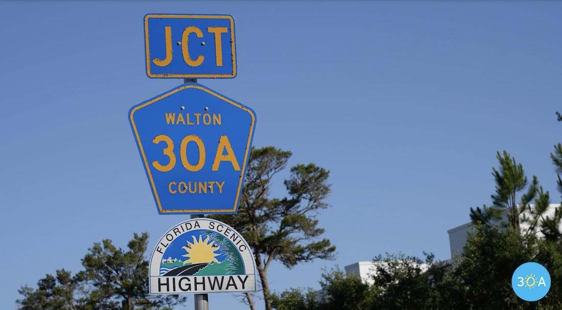
In 1977, State Road 30A was transferred to Walton County and renamed yet again as County Road 30A.
A few years later, in 1981, Seaside was founded, setting the standard for architecture along 30A and eventually paving the way for development to begin in earnest.
Seaside, heralded as the first New Urbanist development, was designed as a new but old-fashioned-looking beach town with wood-framed cottages, a town square, and walkable access to housing and shopping. It grew slowly, but the concept drew attention from around the country and eventually the world.
As more people began to show interest in developing communities along 30A, groups of concerned residents focused on protecting the area’s unique natural lands. They came together to save Grayton Beach and Topsail Hill Preserve state parks, which run along 30A.
“We, the people, citizen action groups up and down the corridor, had a keen interest in keeping the beauty of the Gulf of Mexico vistas and the local forest,” said Claire Bannerman, who would later become an instrumental force in the road’s history. “It was absolutely beautiful, the loneliness of it. The citizens were very protective.”
In 1984, a group of residents working under the name Citizens for a Bike Path came before the Walton County commissioners to propose a bike lane running alongside County Road 30A, according to county records. Later that year, the county appointed a task force to begin working on the project.
The project was completed in sections, many spearheaded by Commissioner Van Butler. Ken Little, who worked in county administration for over a decade, recalls that in the late 1990s, Butler proposed a simple trail be cut along the path during a resurfacing project on 30A. It would avoid driveways, trees, and shrubbery and could be cut through county right-of-way using county workforce.
“The plan was to use the millings from the 30A resurfacing job to pave the path, saving the cost of hauling the stuff away,” Little said. “The board agreed, and pretty much the next morning a tractor from the District 5 road crew was hauling a box blade down the side of the road digging out the path.”
As the road resurfacing project continued, the milling machine blew the old asphalt into the trench. A crew spread it, following up with a roller to smooth it out. “It was a marvelous idea and wonderful execution in its time, in my humble opinion,” Little said.
Over the years, the path was improved and expanded, connecting along the length of 30A.
By the mid-2000s, two decades after citizens first pitched the concept, the Timpoochee Trail, as it is now known, was complete, according to county records.
By that time, development had really stepped up along County Road 30A. In 2005, Walton County Commissioner Cindy Meadows tapped Bannerman to pursue an official Scenic Highway designation from the state. The designation would put in place preservation measures and development restrictions and guidelines.
“It was our goal to keep it scenic,” Bannerman said. “We wanted to preserve every bit of it because overdevelopment was taking over, and the county commissioners were authorizing mitigation and exemptions.”
Some guidelines included no billboard advertising along the road and protecting the vista views of the gulf and the coastal dune lakes. They also included improvements to the look and lighting of the bridges over the lakes, a natural phenomenon only found in a few places worldwide.
“We wanted to make it so when you drove over the coastal dune lake, you knew you were driving over a rare body of water,” Bannerman said. “People were unaware of it.”
It took four years to get approval from the state. Finally, in 2008, the old county road again found itself with a new name, Scenic Highway 30A. In 2021, 30A received a national designation as a scenic highway, as well.
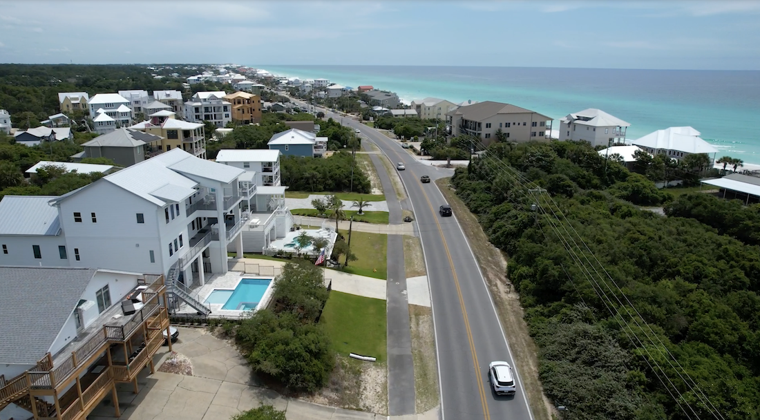
In the past several years, traffic, overcrowding, and parking have become significant concerns along Scenic Highway 30A. Improvements are needed, but residents continue to advocate for preservation of the beauty and natural resources of the roadway.
Leigh Moore, executive director of the non-profit Scenic Walton, said her organization is just starting to undertake some preservation and beautification projects along 30A with plans for more, including an effort to get utility cables taken underground.
“30A is growing like crazy with a ton of redevelopment, some new development, and we just felt the pull to say, hey, let’s make sure it’s done well and done, right,” she said. “We can’t always make that happen, but we do our best to have an impact where we can.”
Early 1900s – a rut road is formed running along the coast from wheel tracks left by the few visitors and residents who travel along it
1937 – Florida officially names the rut road State Road 237
1958 – Florida changes the name to State Highway 30A
1959-1961 – The project to pave State Highway 30A is underway
1977 – 30A is transferred to the county and is renamed again as County Road 30A
1984 – citizens propose adding a bike path next to 30A
Late 90s – large section of bike path is added
Mid-2000s – bike path is complete and named Timpoochee Trail
2004 – county officials and interested parties begin pursuit of state scenic highway designation
2008 – 30A is renamed again as Scenic Highway 30A
2021 – Scenic Highway 30A becomes a national scenic highway as well